


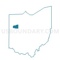
BLUFFTON VILLAGE C Voting District, Allen County, Ohio
About
Outline

Summary
| Unique Area Identifier | 642575 |
| Name | BLUFFTON VILLAGE C Voting District |
| County | Allen County |
| State | Ohio |
| Area (square miles) | 0.83 |
| Land Area (square miles) | 0.83 |
| Water Area (square miles) | 0.01 |
| % of Land Area | 99.25 |
| % of Water Area | 0.75 |
| Latitude of the Internal Point | 40.88064600 |
| Longtitude of the Internal Point | -83.89435500 |
Maps


Graphs
Select a template below for downloading or customizing gragh for BLUFFTON VILLAGE C Voting District, Allen County, Ohio


Neighbors
Neighoring Voting District (by Name) Neighboring Voting District on the Map
- BLUFFTON VILLAGE A Voting District, Allen County, OH
- BLUFFTON VILLAGE B Voting District, Allen County, OH
- BLUFFTON VILLAGE D Voting District, Allen County, OH
- Voting District ORANGE, Hancock County, OH
- RICHLAND TWP A Voting District, Allen County, OH
- RICHLAND TWP B Voting District, Allen County, OH